Urban Visualization: Legible Cities
Eric Sauda and Ginette Wessel are in collaboration with Bill Robarsky, Remco Chang of the VIS Center. This project uses an algorithm developed by Chang to study urban form in a range of cities from different historical periods.
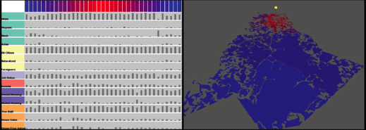
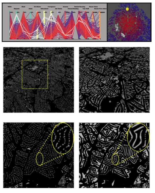
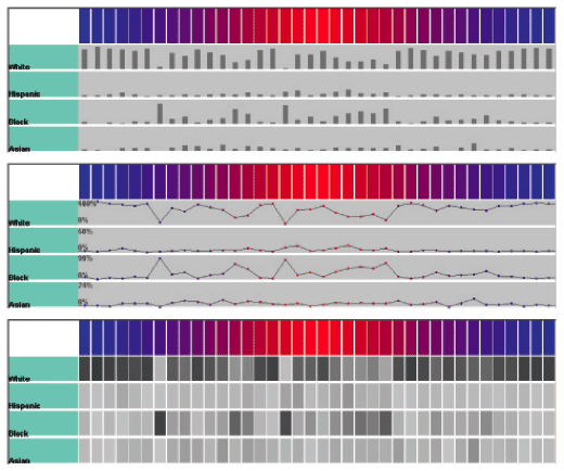
Prior systems developed display collections of data for urban contexts; however, most have focused on layering of single dimensions of data and manual calculations to understand relationships within the urban environment. Furthermore, these systems often limit the user’s understanding of the viewing region. Our research introduces a highly interactive urban visualization tool that provides intuitive understanding of the urban data. The system utilizes an aggregation method that combines building and city blocks into legible clusters, thus providing continuous levels of abstractions while preserving the user’s mental model of the city. In conjunction with a 3D view of the urban model, a separate but integrated information visualization view displays multiple dimensions of the urban data, allowing the user to understand the urban environment both spatially and cognitively in one glance. This interactive tool allows for visualization an urban model in a focus dependent and multi-resolution fashion both geometrically and concerning the underlying data while retaining the legibility of the city.
9.12.11